Zone System
Divide your space into meaningful areas and let Blecon tell you exactly what's where. Zones power geofence alerts, occupancy monitoring, and asset organisation, from individual rooms to entire campuses. Define a zone once, then build any number of alert rules on top of it.
Blecon gives you two types of zones that work together, so you get the best of both worlds: precise proximity detection indoors and flexible geographic boundaries everywhere else.
Zone types
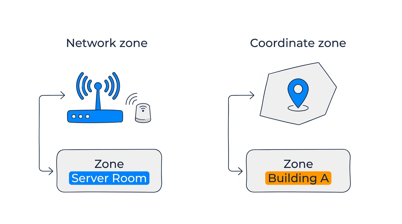
Blecon has two types of zones that work in parallel:
Network zones
Network zones are proximity-based: a tag is "in" the zone when it's detected by a hotspot or anchor assigned to that zone. Create one from Zones → + Add Zone → Network zone, or under Zones → Network Zones. Then assign it to an anchor. A network zone can be used in alert rules as soon as you create it. It appears on the map once tags are seen in it.
Network zones appear on the map as points (the hotspot's location), not as drawn boundaries. Best for indoor environments where you want room-level or area-level presence.
Coordinate zones
Coordinate zones are geographic boundaries that you draw on the map in Blecon Track. A tag is "in" the zone when its GPS coordinates fall within the polygon. Create one from Zones → + Add Zone, then choose Search for an address to drop a zone around a place, or Draw on the map to click out the shape yourself. Import a list creates many at once from a spreadsheet — see Bulk import.
Coordinate zones support two shapes: - Polygon: Freeform boundary drawn by clicking vertices on the map. - Bounding box: Rectangular area defined by north/south/east/west coordinates.
A tag can be inside multiple coordinate zones simultaneously (e.g., overlapping "Building A" and "UK Sites" zones).
How small a coordinate zone can be
A coordinate zone works only if a position can tell inside from outside. Every position carries an estimated accuracy, and Blecon keeps a position only when that accuracy is better than your accuracy filter. On the Balanced profile the limit is 110 metres.
Draw each zone wider than that limit at its narrowest point. A narrower zone cannot tell inside from outside reliably, because each position lands somewhere within its own accuracy radius.
The zone editor measures the shape while you draw it. It shows the narrowest width of the zone next to the width your workspace needs, and it warns you when the zone is too small to give reliable results.
Indoors, a network zone is usually the better answer. It uses proximity to a hotspot or an anchor instead of a boundary, so it has no minimum size.
The zones list
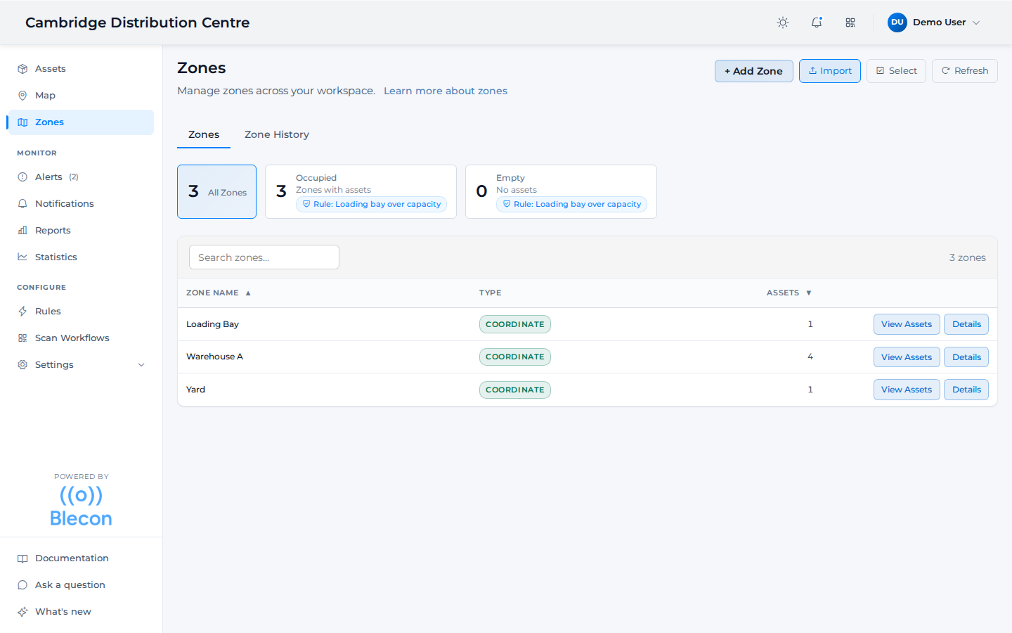
Both zone types share one list, with the current asset count against each. Selecting a zone opens its activity view.
How tags are assigned to zones
- Network zones: A tag has at most one network zone at a time, determined by the strongest hotspot/tag signal.
- Coordinate zones: A tag can be in many coordinate zones at once, determined by spatial containment queries against its GPS position.
Both zone types appear in the zones list and support alert rules, zone tags, and asset counts.
Zone tags
Tags let you group zones for bulk rule management. Instead of creating separate rules for 50 parking zones, tag them all with parking and create one rule that targets the tag.
Tags are set when creating or updating a zone and can be used by any alert rule that accepts zone targeting.
Zone asset counts
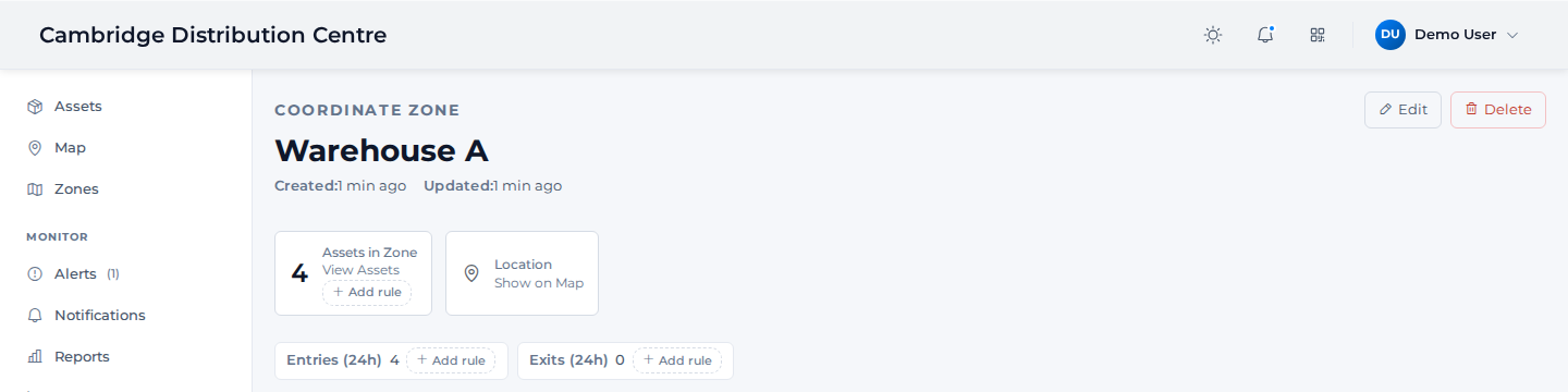
Each zone displays a count of how many assets are currently inside it, along with entries and exits over the last 24 hours. + Add rule next to any of these creates a rule targeting that zone directly. You can use the zone asset count alert rule to trigger alerts when counts go above or below thresholds.